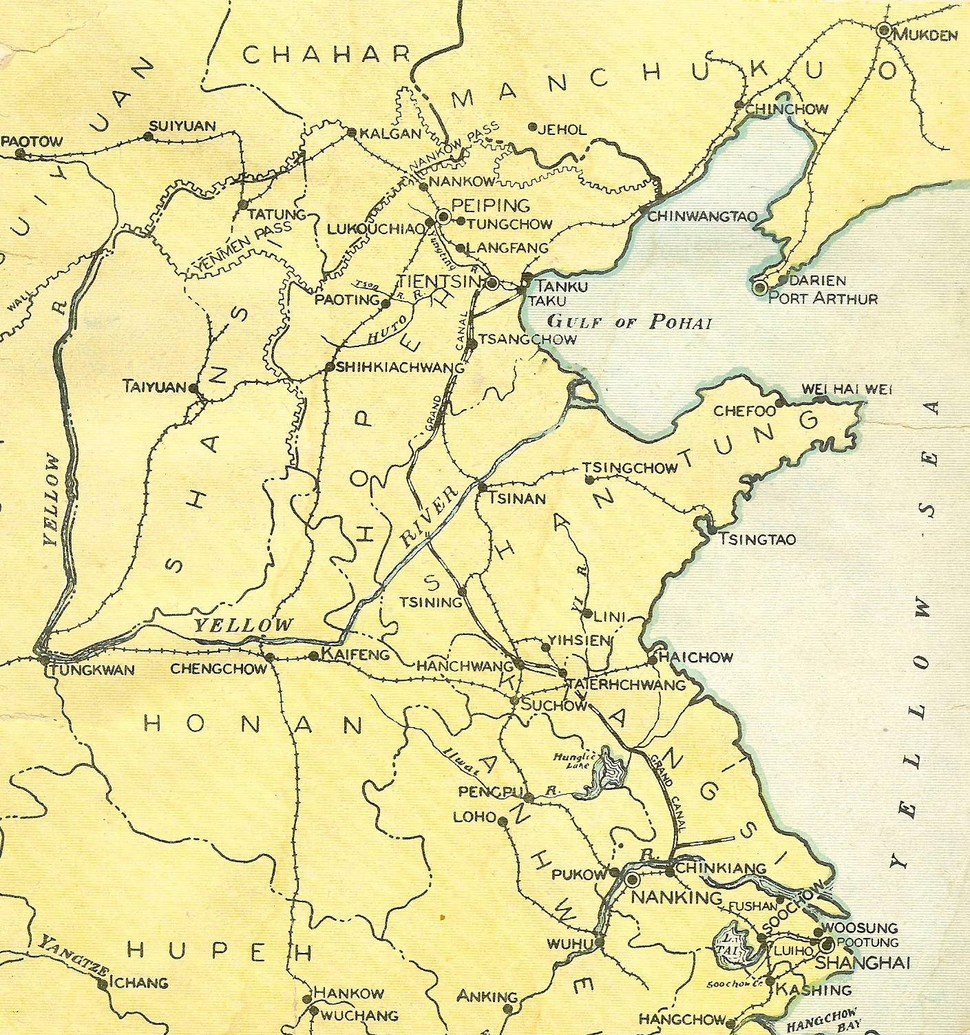
This map taken from the cover of the June 1941 "North China Marine" magazine illustrates nicely China from a Marine's prespective. The map highlights Peiping, Tientsin, Chinwangtao, Shanghai and the well visited treaty port cities along the coast, and the Yangtze River.
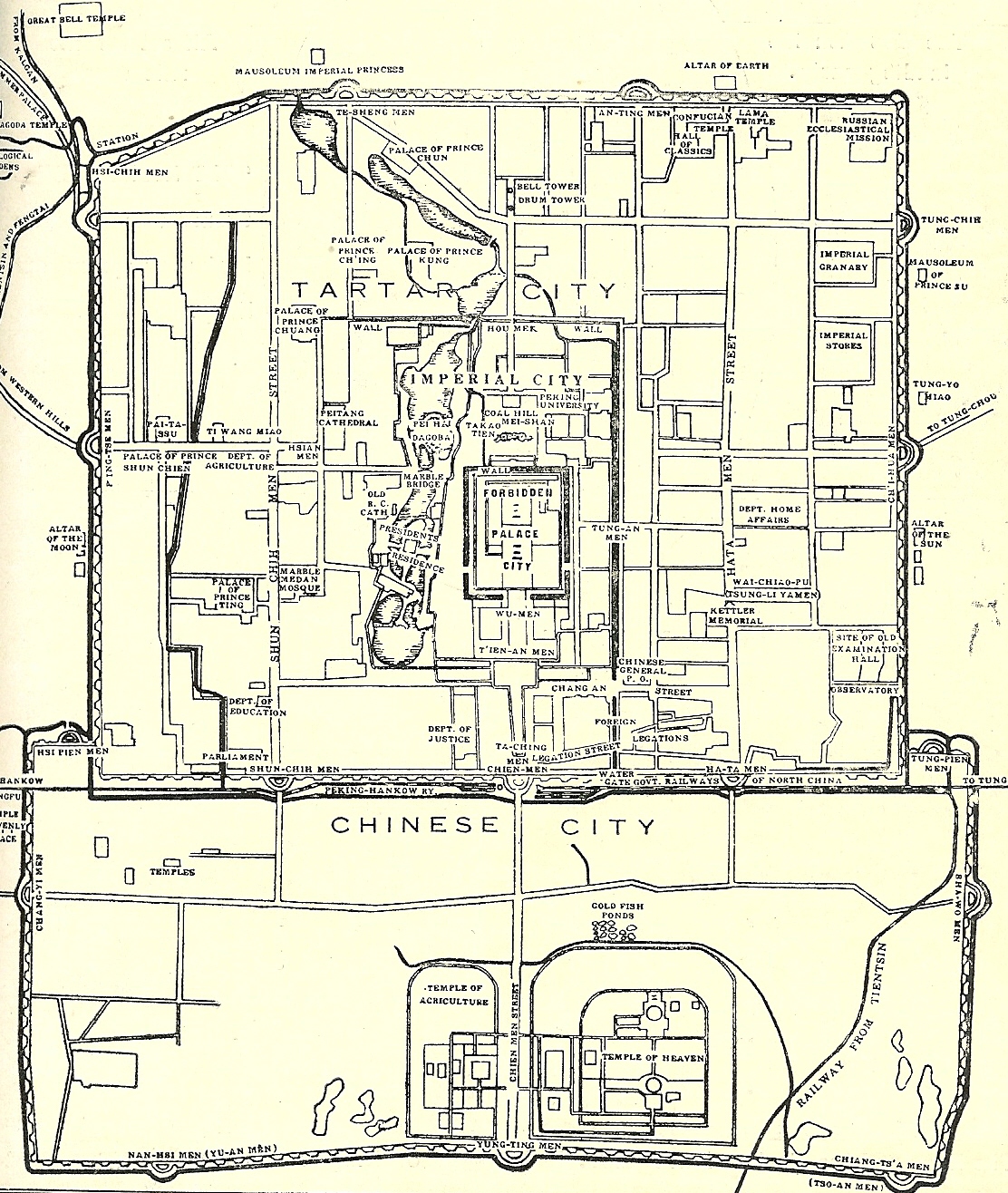
The city of Peiping, c. 1934.
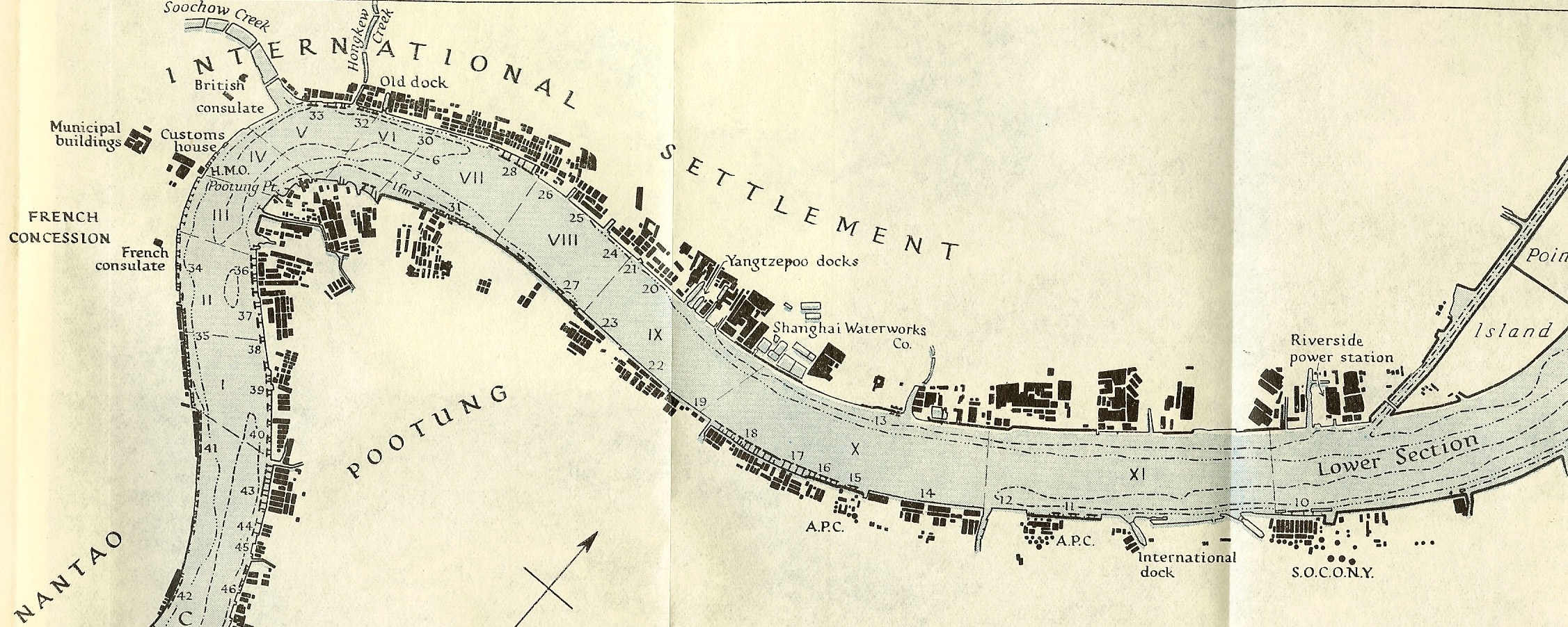
Map of Shanghai Harbor. This map was taken from a pre-WWII era British Naval Intelligence Division publication, that highlighted a number of facilities Marines would have seen as they sailed into Shanghai.
Shanghai
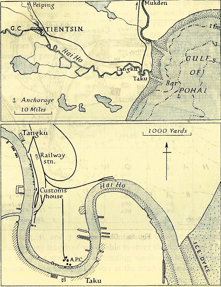
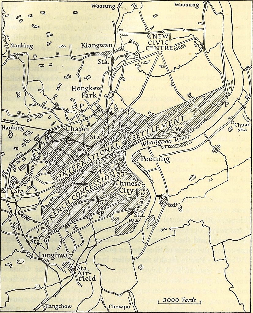
Tientsin and theTaku Bar. Prior to utilizing Chinwangtao in the 1920's, Taku was the main entry point for North China Marines. Note the Taku anchorage was almost ten miles off shore.
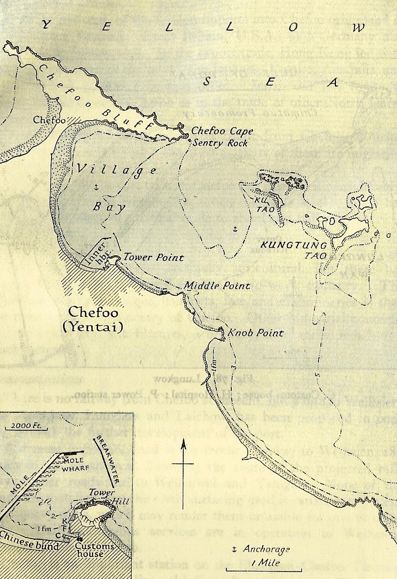
Chefoo, served as the Asiatic Fleet Summer training area. I believe Kungtung Tao Island was know to sailors and Marines as Kentucky Island. The island was rented from the Chinese government for fieldcraft training for the Asiatic Fleet.
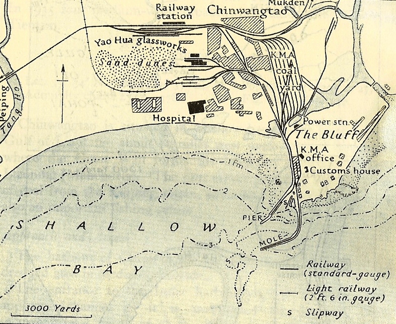
Chinwangtao. This was the deep water port for North China prior to WWII, and the main arrival point for Peiping/Tientsin based Marines. Chinwangtao was also the location of Camp Holcomb.